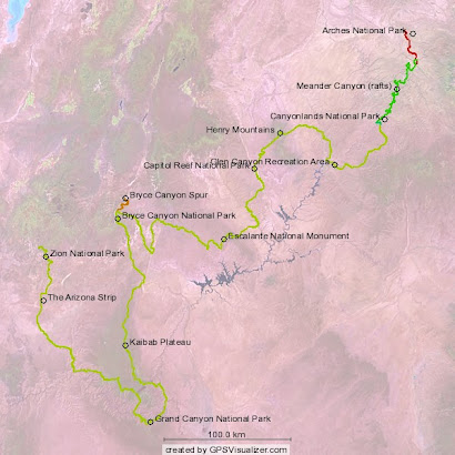
Yes, just a few snafus to be sure. We cached food, and supplies in two locations-- the first in the Burr Trail area of Capitol Reef National Park (see photo, Henry Mountains in background) and the second near the Arizona Strip segment of the hike.
In the latter case, it was disquieting to watch the interment ceremonies as the sun was beginning to set, not knowing what type of shape we would be in when we found ourselves once again very concerned with locating this tiny, nondescript patch of soil so stealthily concealed in the middle of nowhere. Our survival across the strip, while not garaunteed, would be greatly enhanced after digging up the contents of this cache. Relying on a food cache is not something I have done on a long hike. I definitely prefer the certainty factor of a mail-in resupply, owing to the obvious contingency of shopping for food should something happen to the resupply box. To heighten the anxiety, the the oft-cited problem with a blind dependence on technology did manage to rear its ugly head: the batteries on my GPS completely died before the coordinates could be saved. Fortunately, in an age of highly competitive technologies, we found the necessary redundancy in my Blackberry, whose GPS function I never really felt like I would use. But I gladly did then. After photographing the area and promising to remember this skyline, that tree, and that "rock over there", we left with a certain unease which was quickly supplanted by the good feelings of having made some progress toward our ultimate departure. Probably good that we didn't bury that tequila-- getting to Zion from the canyon rim via the Arizona Strip will not be too forgiving of a confused state of mind!